The new hiking map of the Swiss Hiking Trail Federation
As of 17 November, the map on schweizer-wanderwege.ch covers winter too. It suggests hikes in a list right beside it, and the filters narrow them down by distance, altitude and difficulty. The map layers let you show fire pits, trail closures or the current snow depth. A wander through what’s new, with a look behind the scenes.

The map is the heart of the Swiss Hiking Trail Federation’s platform, and there is a lot on it: more than 1,700 hiking suggestions, guided hikes, hikers’ inns, fire pits and hiking hotels. For the winter season, we gave it a thorough overhaul together with the umbrella organisation. It has new content, newly built controls and a tour that shows you what’s new in five steps.
Where to next?
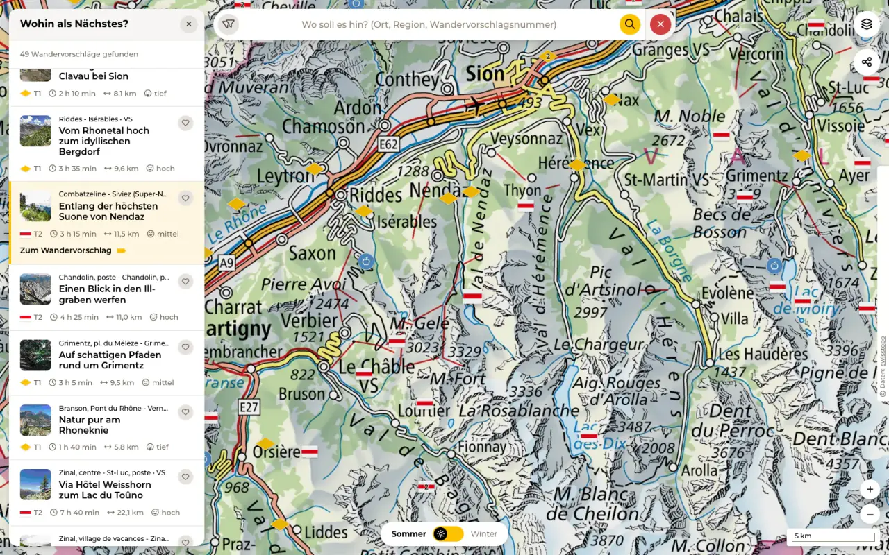
A list right next to the map now answers that question. It shows the hiking suggestions and guided hikes in the visible area and updates as you zoom or pan the map. If a guided hike is cancelled or fully booked, it says so before you fall for it. Each entry gives the difficulty, duration, distance and physical demand. One click, and the map zooms into the region, where the hike’s marker stands out from the rest.
Narrow it down
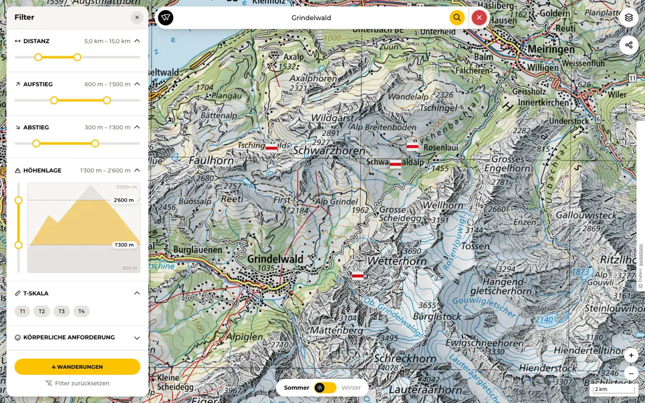
The search box finds places, regions and the number of a hiking suggestion. For anything more specific, there are the filters. They now have a panel of their own and more choice: distance, ascent and descent, altitude, difficulty on the T scale, physical demand, a date range for guided hikes and, for regulars, only your own favourites. The button below keeps count of how many hikes are left, so you notice in time when you have filtered yourself down to zero.
A switch for winter
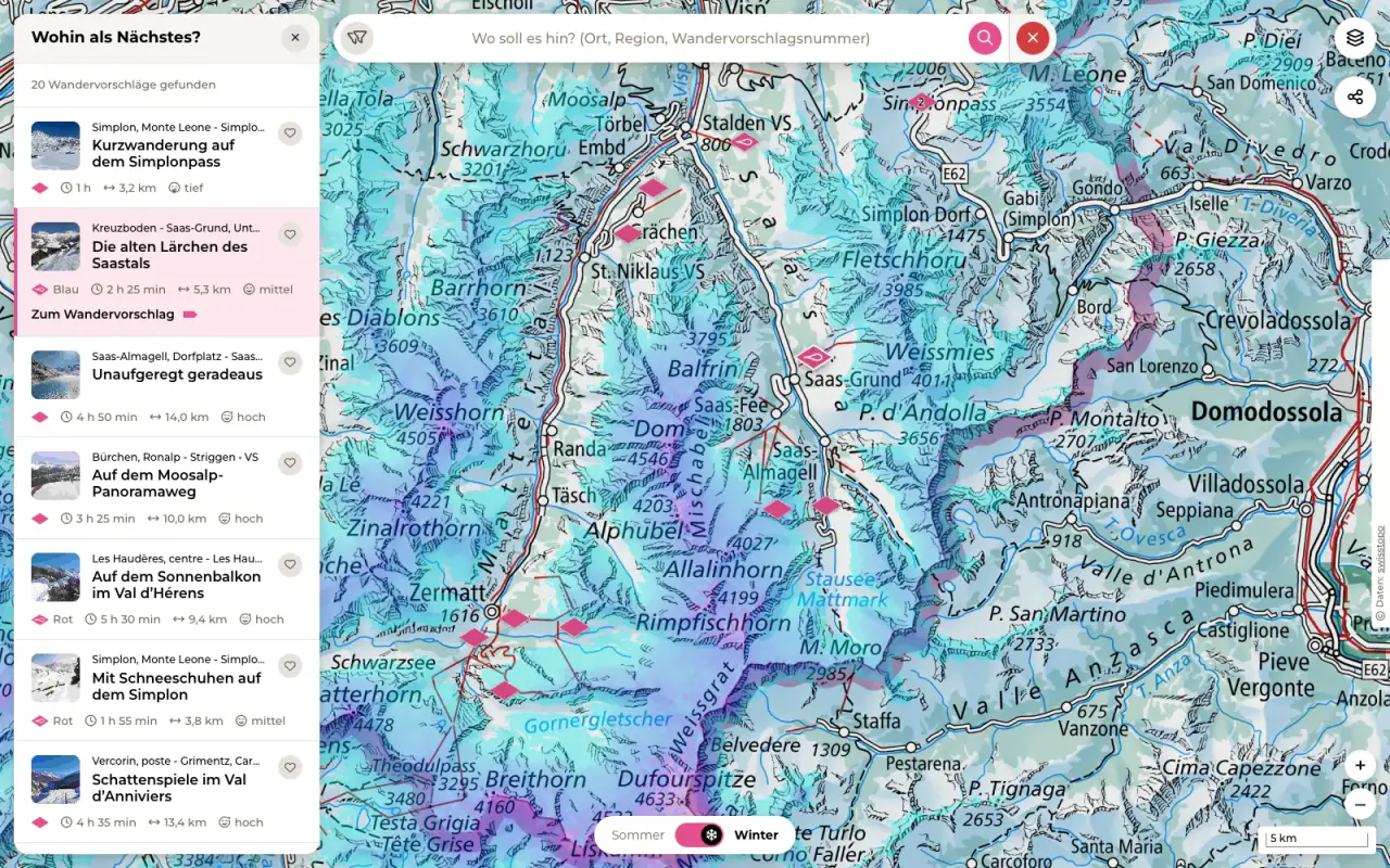
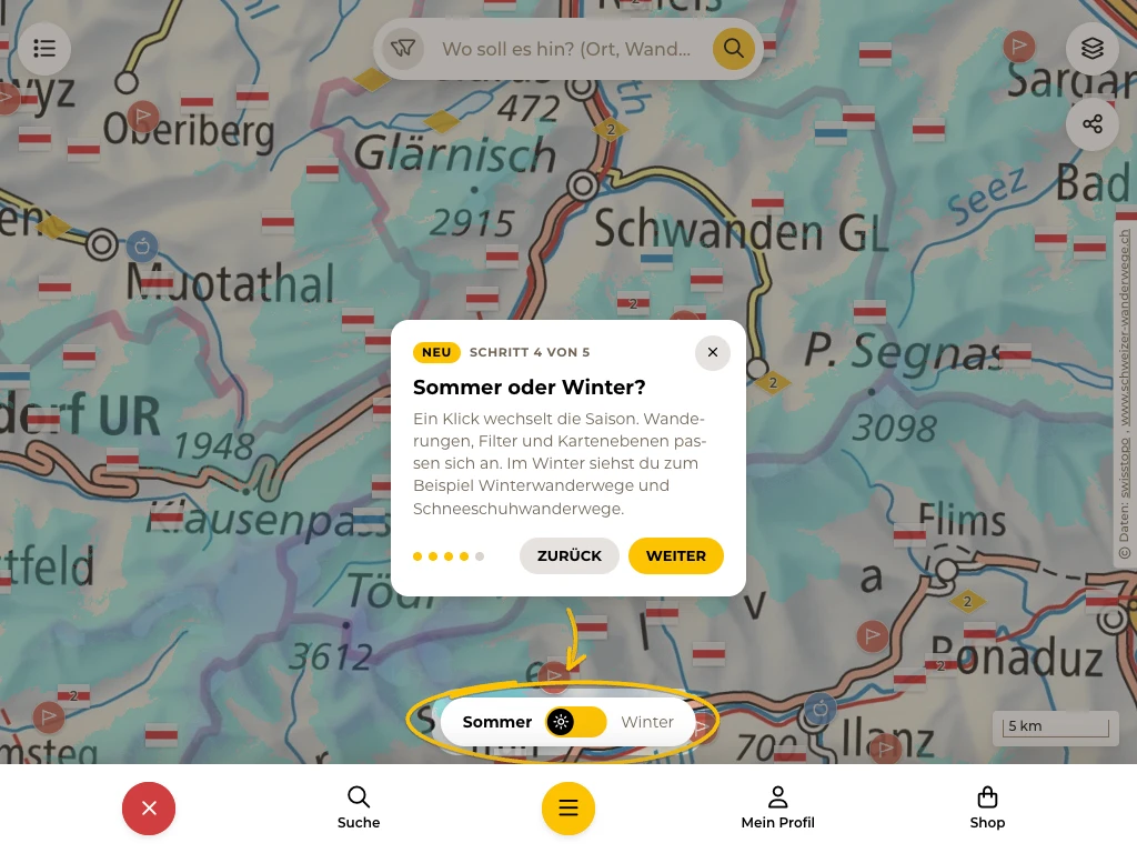
One switch changes the season, and hiking suggestions, filters and map layers change with it. In winter, winter hiking trails and snowshoe routes appear and, if you like, the national map in its winter version and the current snow depth from Exolabs. You can spot winter routes in the list by a small pictogram. Snowshoe routes show their difficulty as a colour, such as blue or red, and in the filter you decide how red it may get. In summer, the map clears winter and snowshoe hikes away again, so that nobody packs snowshoes in July.
What else the map knows
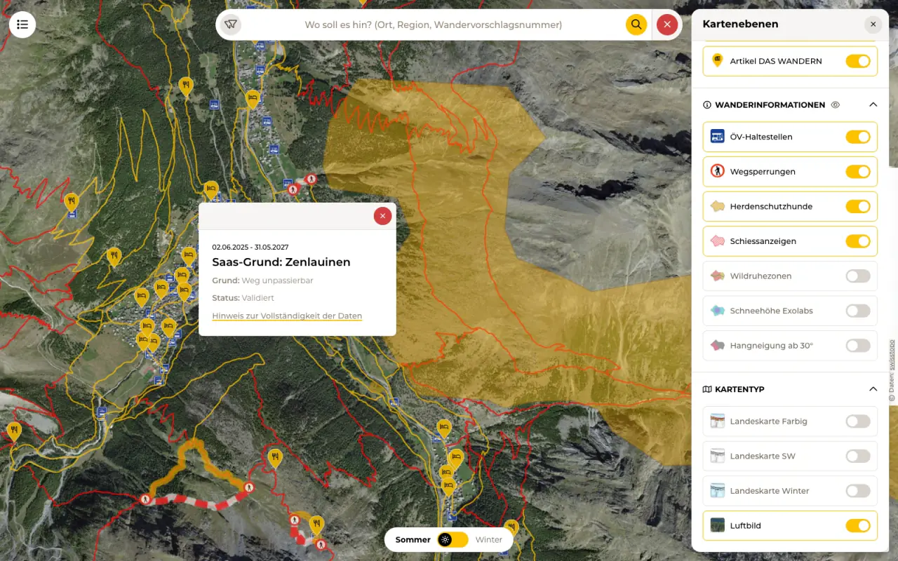
In the ‘Map layers’ panel, you switch whole groups on and off. The hikes group covers the hiking trail network, the winter hiking trails and the snowshoe trails. The places group is about everything that makes a hike better: hikers’ inns, hiking hotels, fire pits, hiking videos and articles from the magazine DAS WANDERN. Cantonal organisations add places of their own, such as trailside benches in the canton of Zurich and farm shops in the canton of Lucerne.
Under ‘Hiking information’ you will find what you would rather know beforehand: public transport stops, trail closures, alpine pastures with livestock guardian dogs, firing notices, wildlife rest areas, slopes of 30 degrees or more and the snow depth. Click a trail closure to see when it applies and why. As a base, you can choose the national map in colour or in black and white, the winter map or the aerial image.
Most layers come from swisstopo. Some only become legible from a certain zoom level. If you switch on such a layer too early, the map zooms in by itself instead of leaving you staring at a blank map.
One link for the whole hiking group
Anyone who has ever had to explain in the group chat exactly which hike they meant will like this button. It creates a link that keeps the map view, the selected layers and the filters. Everyone who opens it sees exactly the same map. The button is also on the pages of the individual hikes.
A tour instead of a manual
Hardly anyone enjoys reading instructions, least of all before a hike. That is why a short tour starts on your first visit. It opens the list, the search with the filters, the map layers, the season switch and the share button one after the other. The map around them is dimmed, and a loop with an arrow, as if drawn by hand, shows what each step is about. It all takes less than a minute. Click ‘Later’ and the tour comes back after three days. You can restart it at any time with the question mark at the bottom left.
Behind the scenes
For the new map, we rebuilt the controls as components of our own. That has a pleasant side effect: list, filters, map layers and sharing look and behave the same everywhere, on the overview map, on the hike pages, for planned hikes and in the route planner, where hikers draw their own routes. Which layers exist is defined in one single place. And because the map carries its entire state in its URL, the share link came about almost by itself.
The new map is online at schweizer-wanderwege.ch. Bring on the winter.
 Lukas Knöpfel
Senior Fullstack Software Developer
 Urs Imhof
CXO / Senior UX Designer & Researcher